Raised relief map Switzerland aerial 1:500.000


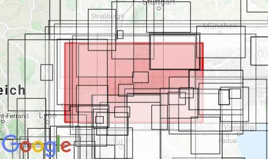
Kartenabdeckung (rot markiert)
Klicken Sie hier um die Kartenabdeckung in unserem Kartenviewer zu inspizieren.