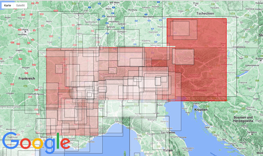
Since June 2025, we have been able to ship a new edition of our three Alpine maps at a scale of 1:500,000, with a total format of approximately 243 x 123 cm, in one package. You can order all three maps together. The maps overlap to create a complete image of the Alpine arc. There is no machine capable of thermoforming that large, and shipping would be incredibly expensive. Please note: the design has changed.
Order and view our three raised relief maps of The Alps 1: 500 000. The maps overlap about 3cm, so that it gives a complete picture of the Alpine arc.
>> more details on the western part of the Alps 1:500.000
In the northwest is the Plateau de Langres, in the northeast Colmar, in the southeast are the Maritime Alps with the Cime de Gélas and in the southwest Nîmes and Alés. Thus, a large piece of the Rhône Valley and the Ardèche are on the map. The Mont Blanc massif and all the other important mountains in the Western Alps can be found from the Alps. The Mont Ventoux is shown in full in the south.
>> more details on the relief map Alps 1: 500.000
Raised relief Alpine map from Mont Blanc to Grossglockner and from Munich to Verona. Not only the red, blue, yellow, violet and the green path of the Via Alpina are represented on this relief map of the Alps, but also other interesting hiking trails and alpine crossings. This 3D map of the central Alps is therefore not only a beautiful 3D wall map for your office or home, but can be very helpful in the planning of your Alpine activities by the scale of 1: 500,000.
>> more Details on the relief map Alpen-Ost 1: 500.000
Relief map of the Alps East from the Großglockner to Vienna and from the Bavarian Forest to Venice. This 3D map of the Eastern Alps 1: 500,000 shows large parts of Austria and also the Bavarian and the Bohemian Forest.
This 3D map of the Eastern Alps is not only a beautiful 3D wall map for your office or home, but can be very helpful in the planning of your Alpine activities by the scale of 1: 500,000.
Producer: Geo-bit Holzstraße 13/1 72622 Nürtingen www.3d-relief.com
Elevation: 2.5
Scale: 1: 500,000
Size: 243 x 120 cm (each map 93 x 63cm)