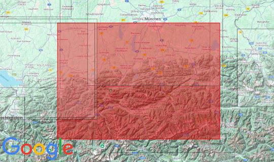
Our latest map 2023: good things take time. And hopefully as successful as our other cards. The relief map of the Bavarian Alps and Inn Valley is perfect for our customers from Munich and the surrounding area and of course also for customers from Austria. A map with a scale of 1: 200,000 can be used to plan large tours. We have taken the liberty of including hiking, cycling and mountain biking trails. These are the hiking trails: Adlerweg, König-Ludwig-Weg and Maximiliansweg. For cyclists, the Isar cycle path is shown and mountain bikers will find the Innsbruck and Karwendel Loop on the relief map. The map starts in the northwest with Winterrieden, in the northeast Feichten, in the southeast Virgen and in the southwest Ischgl.
Producer: Geo-bit Holzstraße 13/1 72622 Nürtingen www.3d-relief.com
scale: 1: 200 000
size: 95,8 x 65,5 cm
speech: german


